

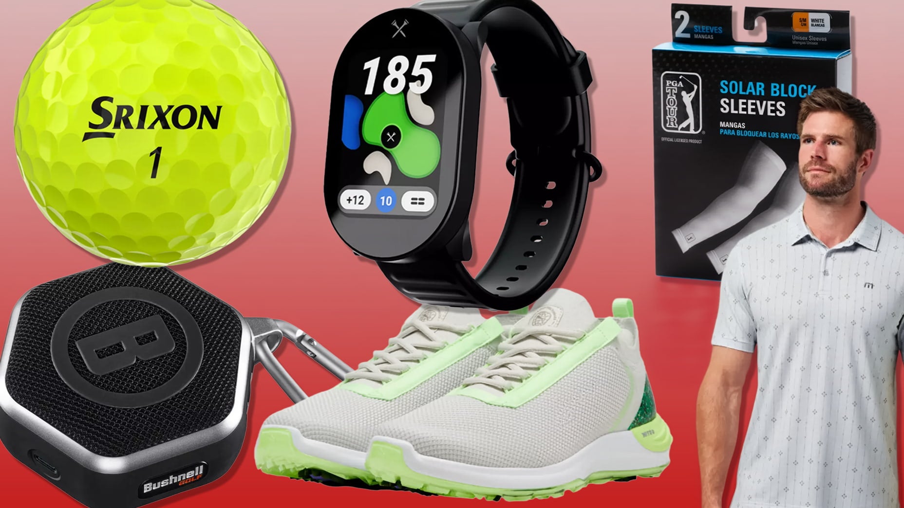
 What I’m snagging at PGA Tour Superstore this July 4th weekend
How this portable scanner has revolutionized green-mapping
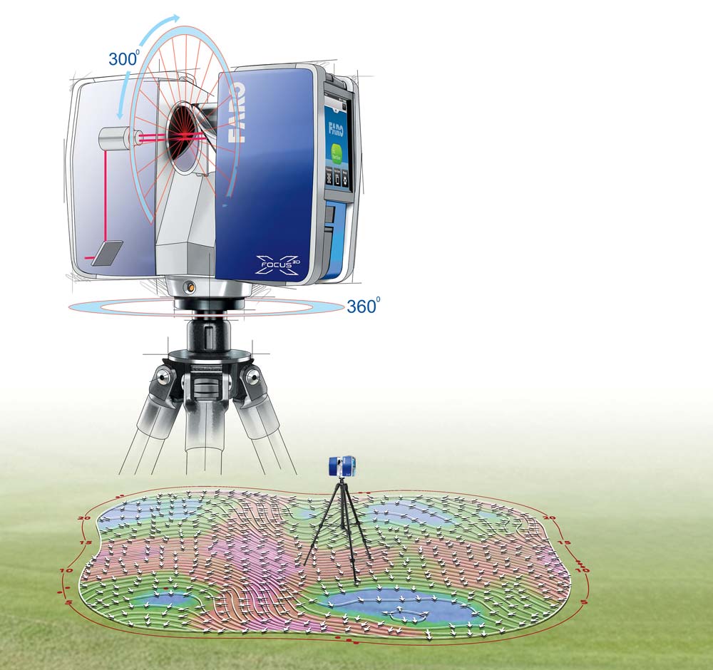
Precision is a nonnegotiable in this game, ushering in an advanced wave of 3D capture and measurement tools that provide data to power everything from course construction to the green-reading apps on your smartphone. The portable scanner by Lake Mary, Fla.–based Faro is an industry leader, and not simply for golf.
The same tech is used to build skyscrapers, manufacture goods and reconstruct crime scenes. Why? Because some things in life — like how much break is in a sneaky 10-footer — require more than “just a hunch.”
1. Laser
Green-mapping requires a scanner like the Faro to take accurate readings of greens. The first step, says Chase Stracka, GM of green-mapping company StrackaLine, which employs the Faro unit, is to coordinate a date with a given club to bring the laser on-site.
“The scanner only takes about eight minutes for each hole,” Stracka says. “So we try to start right at sunrise and we can stay well ahead of the first tee time to complete the course in four to five hours.”
The scanner collects up to two million data points per second by bouncing a laser off a rapidly spinning mirror in the center of the device. Each time the mirror spins, the laser collects data on a 360-degree range of motion to within a millimeter of the slope and pitch of the green.
ADVERTISEMENT
2. Rotating Head
This piece rotates the device while the laser runs. As the mirror spins and the device rotates, the laser collects data in a 360-degree field of view.
3. SD Card and Battery
What makes the laser so valuable to green-mapping technology is its portability. Data is stored on an SD card attached to the mainframe of the device, and the device comes with a portable battery that allows it to run without wires for upward of four hours on a single charge.
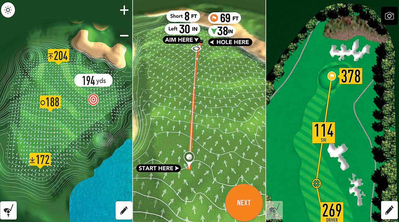
Once a scan is complete, the SD card can be connected to any computer and the data added to CAD software. The software interprets the data into charts that calculate the break, severity and slope of the green. From there, the charts make their way into the hands of golfers via printouts and smartphone apps.
“Extremely accurate green contour data is a game changer,” says Pete Charleston, president of the popular GolfLogix app, which is owned by GOLF.com’s parent company. “Using our product is like playing with a great caddie, with data that produces a perfect putt line and shows golfers exactly where to aim to help make more putts.”
If you don’t think big data is making the game easier, think again.
To receive GOLF’s all-new newsletters, subscribe for free here.
ADVERTISEMENT
What I’m snagging at PGA Tour Superstore this July 4th weekend
 Skip the cart fees: 5 golf push carts we love
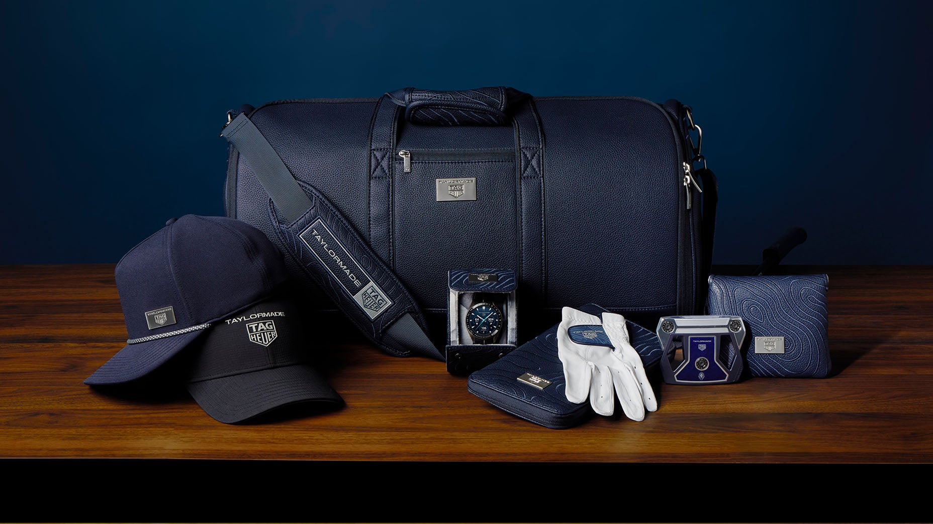 TaylorMade and TAG Heuer partner up for limited edition launch
 Deal alert! This best-selling putting aid is on sale for a limited time
 Save up to 67%: 6 golf deals worth buying right now